Demolition
The city was bisected by a water-filled anti-tank ditch with an open field of fire in the direction of the city centre. To construct these defences, the occupation authorities designated a 350-metre-wide strip of land running from Kijkduin to Zorgvliet.
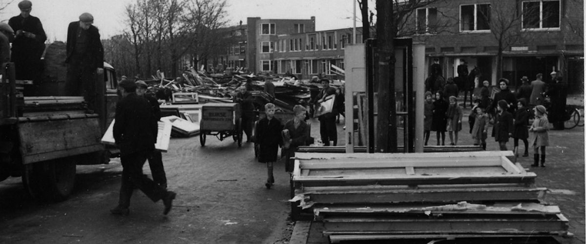
In order to minimise damage to the city, the route followed the Haagse Beek watercourse and the Sportlaan (a main highway). Behind the Gemeentemuseum, the line of the anti-tank ditch was extended in the form of a concrete wall stretching right into the Scheveningen Woods. At the lake known as the Waterpartij, the wall gave way to another anti-tank ditch, extending to the Malieveld, Haagse Bos and on towards the sea. To clear this route, around 2,500 homes, various churches and schools, some bridges and a hospital were demolished within a period of four months. In addition, trees were cleared in the Scheveningen Woods and elsewhere. At first, the Gemeentemuseum was also designated for demolition but in the end (following protests by the director and officials) the building only had to be vacated. Even so it suffered considerable damage from 1943 onwards as a result of its abandonment, water damage and a V2 crash in the vicinity.
The demolition work was organised by the city’s Public Works Department and carried out by subcontractors. Because of the lack of construction work, firms jumped at the chance. The demolitions made a huge impression on people in The Hague.